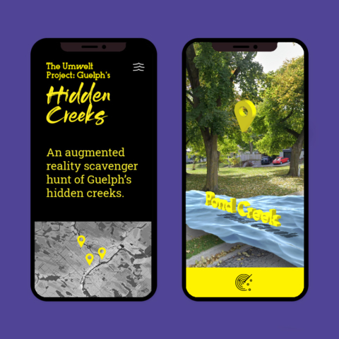
Hidden Creeks, an AR geolocation scavenger hunt.
Hidden Creeks, an AR geolocation scavenger hunt.
The Challenge
How can we reimagine new public storytelling techniques that strengthen the connection, education, and history of Guelph’s hidden waterways?
The Result
Browser-based augmented reality (WebAR) hunt to uncover hidden 3D sculptures of creeks and waterways around Guelph, Ontario. Geolocation pins allow visitors to discover, acknowledge and share educational information about each curated location.
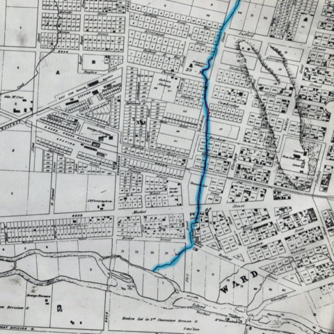
If we’re not connected to the water, we won’t protect it.
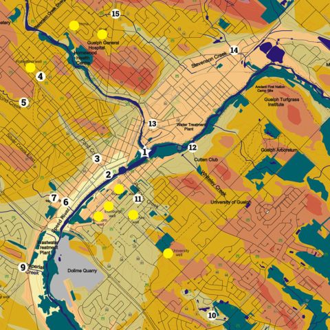
Site Identification highlighting hidden creeks, wells and historic locations such as old mills and dams.